King’s Highway to Heyhouses (with return via Whin’s House)
After parking on Clitheroe Road the group walked along the track towards the Craggs Farms until it met the junction with the King’s Highway. The group walked down King’s Highway into Heyhouses. The road was followed to Sabden Bridge.
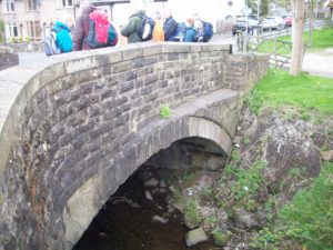
Sabden Bridge
The walk looked at tracks, roads and field systems which could be part of the vaccary at the Craggs.
Kings Highway at Heyhouses
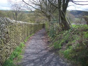
The King’s Highway follows the course of Badger Wells Water. This may form one side of the vaccary complex. The course of the road is clearly visible to Heyhouses. Badger Wells Water King’s Highway looking towards Sabden
Kings Highway on the slopes of Pendle
The last section of road is bounded by a bank on one side and a high wall on the other. The wall is later in date to the walls higher up which form field boundaries, probably dating from the 1600s. The road at this point has been resurfaced for use as a bridleway. Bull Bridge, Sabden It is likely that there has been some sort of bridge or river crossing around this point from an early date. Documentary sources mention a bridge in 1425/4. The name of the bridge could also suggest a link to its use by the vaccary.
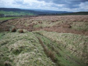
Possible Vaccary features
Bank at side of King’s Highway is still visible, Paling – bank with fence on top topped with Hawthorne in places Potential vaccary winter pasture surrounded by bank with fence on top. This area would benefit from further survey work.
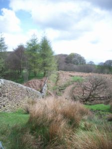
Paling
Appendix 1
Old barn at Cockshutts Farm
The old barn at Cockshutts Farm was found to be very interesting. It has large opposing doors in the style of a threshing barn. The barn has been modified and added to over a long period.
Appendix 2
The return route took in the sights of industrial Sabden. After looking at the site of the toll house on Whalley Road, the group turned right on Whin’s Lane past Whin’s House. Remains of cotton mills (Watt Street) Cobbled track above Whin’s House.
We then followed the track to Parsley Barn before returning to Clitheroe Road.
Cobbled yard, Bench mark, Parsley Barn has been re-roofed
View through Parsley Barn towards Black Hill
Notes
1 The ‘King’s Highways’ were the main routes of the medieval period in areas not served by Roman roads. This old road ran from Clitheroe to Colne. (www.walking englishman.com)
2 Whin is another name for gorse. Word origin of ‘whin’- C11: from Scandinavian; compare Old Danish hvine (græs), Norwegian hvine,Swedish hven (Collins dictionary)
3 Paling – Middle English word dating back to 1350-1400 to enclose with pales, fence.
4 The Victoria history of the county of Lancaster; Vol 6 (1906) Farrer, William